Skip to content
Toggle Navigation
Industries
Precision Agriculture
Research
Renewable Energy
Utilities
Oil & Gas
Civil Construction
Confined Spaces
Maritime Services
3D Digital Twin & Virtual Tour
Environmental Monitoring
Surveillance and Security
Technologies
LiDAR
Bathymetry
UT
Multispectral
Gas Detection
Thermography
Laser Scanner
GNSS
Ultra-HD Images
Drone in a Box
Blog
Company
About Us
Contact
Career
Terms&Conditions
GDPR Policy
Cookie Policy
Resources
Professional Equipment – La Orizont
Drone Pilot Course – Skyline Academy
let’s talk
Blog
admin
2024-08-20T12:51:19+03:00
All
Agriculture
Case Study
Industry experts
Legislation
LiDAR
News
Oil & Gas
Photovoltaics
Renewable
Thermography
Trends
Wind
Official EASA regulations from 1st of January 2024 on the classification and operation of drones – Part I
PIX4Dsurvey: The professional surveying software to get TIN from point cloud fast and easy
How to get Class C2 label for DJI Mavic 3 Enterprise and Matrice 30 drone series. Practical guide
UAV Demo Day 2023 – A unique event in Romania
Innovations in aerial surveying: The collaboration between Phase One, Quantum Systems and Trimble
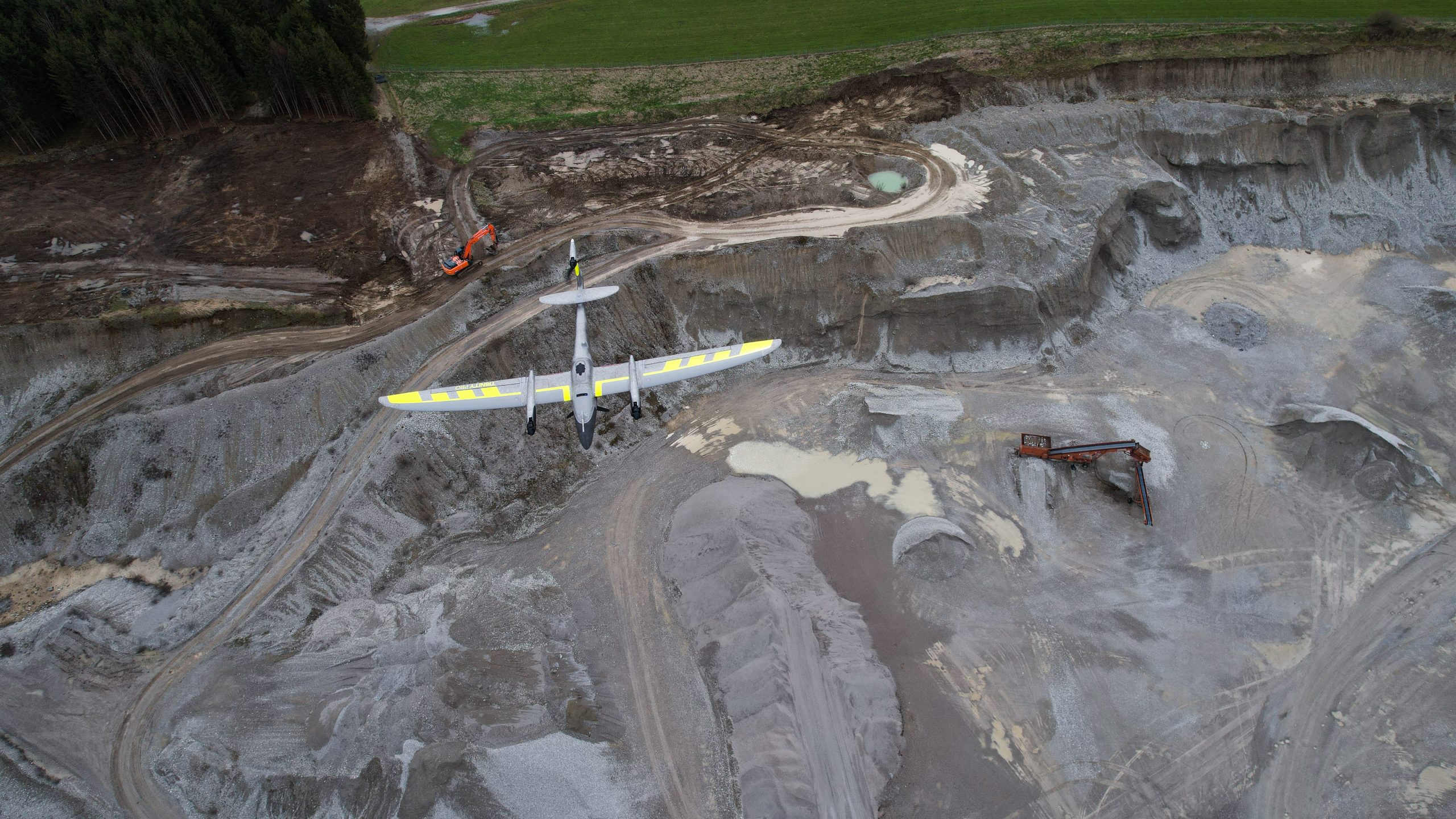
Trinity Pro by Quantum Systems: Setting New Standards in Drone Technology 2023
The role of drones in gas detection and their contribution to environmental protection
Elevate Surveying to New Heights with YellowScan LiDAR Mapper+ and Drones – 2023 Technology
Sitemark and La Orizont & Skyline Drones partner for drone inspections and data analysis of photovoltaic panel parks
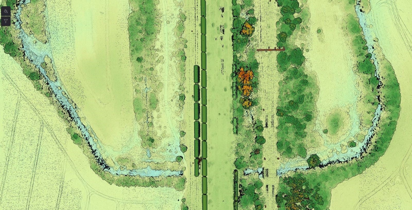
Scanning a railway track with the Trinity F90+ drone and Qube240 LiDAR system to detect possible archaeological sites
YellowScan Fly and Drive – LiDAR system for ground and aerial inspections
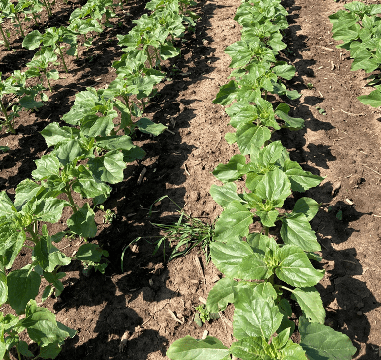
Detecting sunflower volunteers by drone scanning – A case study
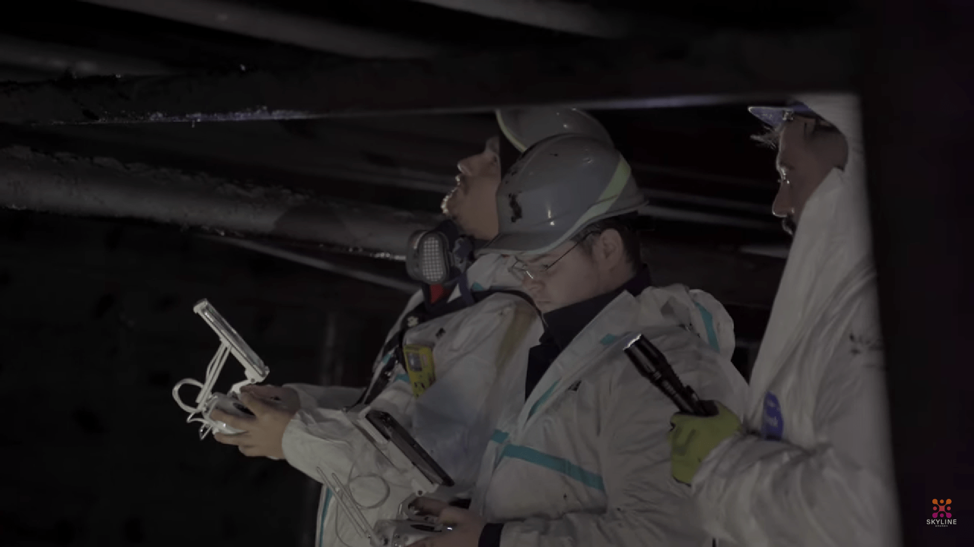
Case study: inspection of sewer systems with confined spaces drones
DJI Air 2S vs Mavic 3 Enterprise: Which one is the right one for you?
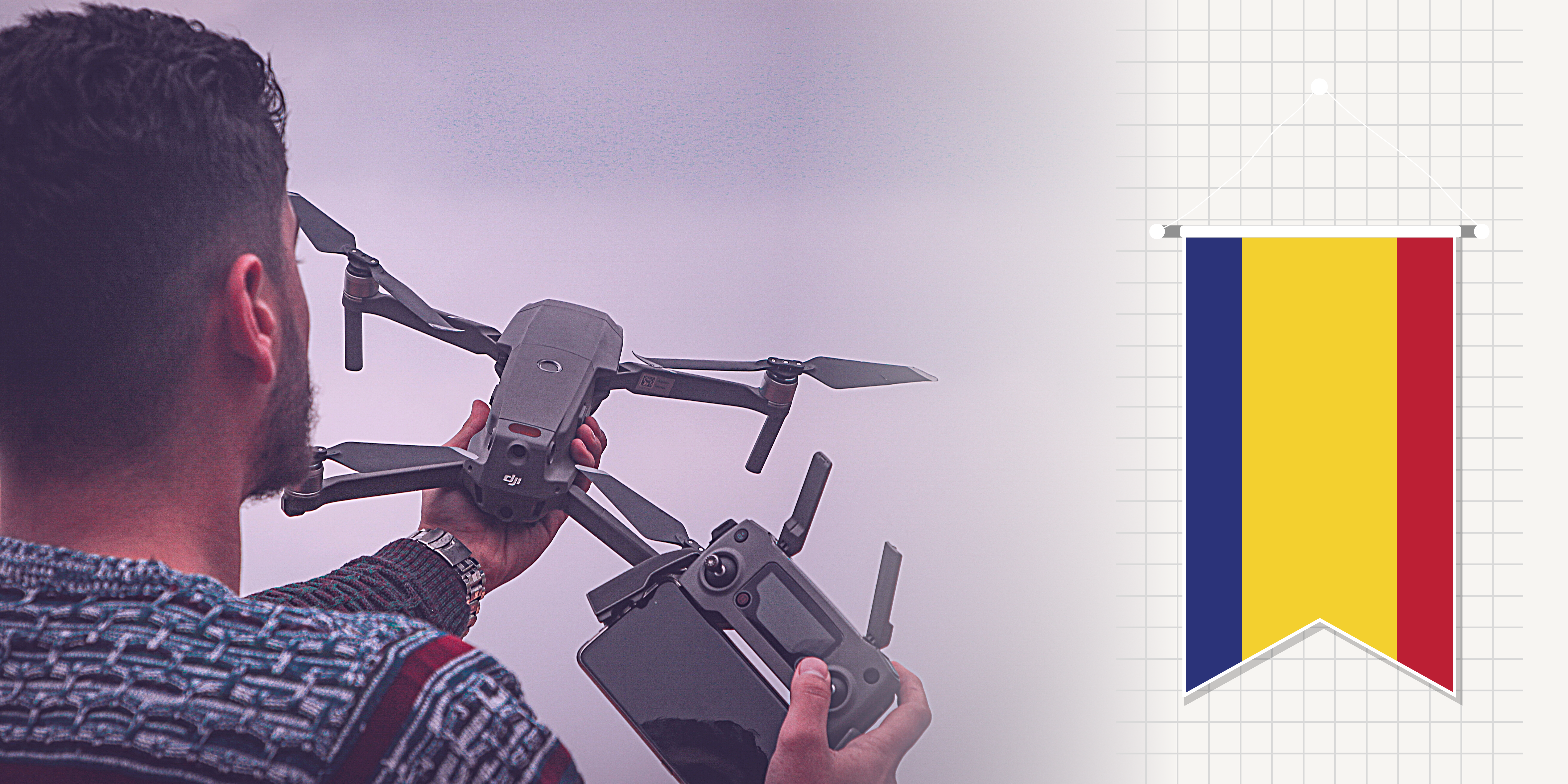
Cum să obții aviz MApN pentru a zbura legal cu drona în 2023 prin noua aplicație AEROFOTO
Bureau Veritas certifies Skyline Drones for UT Drone measurements in a crude oil tank inspection project
Previous
3
4
5
Next
Load More Posts
All
Agriculture
Business
Business Relations
Case Study
Industry experts
Legislation
LiDAR
News
Oil & Gas
Photovoltaics
Renewable
Strategy
Thermography
Trends
Uncategorized
Wind
Official EASA regulations from 1st of January 2024 on the classification and operation of drones – Part I
Gallery
Official EASA regulations from 1st of January 2024 on the classification and operation of drones – Part I
PIX4Dsurvey: The professional surveying software to get TIN from point cloud fast and easy
Gallery
PIX4Dsurvey: The professional surveying software to get TIN from point cloud fast and easy
How to get Class C2 label for DJI Mavic 3 Enterprise and Matrice 30 drone series. Practical guide
Gallery
How to get Class C2 label for DJI Mavic 3 Enterprise and Matrice 30 drone series. Practical guide
UAV Demo Day 2023 – A unique event in Romania
Gallery
UAV Demo Day 2023 – A unique event in Romania
Innovations in aerial surveying: The collaboration between Phase One, Quantum Systems and Trimble
Gallery
Innovations in aerial surveying: The collaboration between Phase One, Quantum Systems and Trimble
Trinity Pro by Quantum Systems: Setting New Standards in Drone Technology 2023
Gallery
Trinity Pro by Quantum Systems: Setting New Standards in Drone Technology 2023
The role of drones in gas detection and their contribution to environmental protection
Gallery
The role of drones in gas detection and their contribution to environmental protection
Elevate Surveying to New Heights with YellowScan LiDAR Mapper+ and Drones – 2023 Technology
Gallery
Elevate Surveying to New Heights with YellowScan LiDAR Mapper+ and Drones – 2023 Technology
Sitemark and La Orizont & Skyline Drones partner for drone inspections and data analysis of photovoltaic panel parks
Gallery
Sitemark and La Orizont & Skyline Drones partner for drone inspections and data analysis of photovoltaic panel parks
Scanning a railway track with the Trinity F90+ drone and Qube240 LiDAR system to detect possible archaeological sites
Gallery
Scanning a railway track with the Trinity F90+ drone and Qube240 LiDAR system to detect possible archaeological sites
YellowScan Fly and Drive – LiDAR system for ground and aerial inspections
Gallery
YellowScan Fly and Drive – LiDAR system for ground and aerial inspections
Detecting sunflower volunteers by drone scanning – A case study
Gallery
Detecting sunflower volunteers by drone scanning – A case study
Case study: inspection of sewer systems with confined spaces drones
Gallery
Case study: inspection of sewer systems with confined spaces drones
DJI Air 2S vs Mavic 3 Enterprise: Which one is the right one for you?
Gallery
DJI Air 2S vs Mavic 3 Enterprise: Which one is the right one for you?
Cum să obții aviz MApN pentru a zbura legal cu drona în 2023 prin noua aplicație AEROFOTO
Gallery
Cum să obții aviz MApN pentru a zbura legal cu drona în 2023 prin noua aplicație AEROFOTO
Inspecting sewer systems with UAVs (confined space drones)
Gallery
Inspecting sewer systems with UAVs (confined space drones)
Previous
3
4
5
Next
Page load link
Go to Top