
Multispectral
Understanding Multispectral Technology
Multispectral imaging is a remote sensing technique that captures images at multiple wavelengths across the electromagnetic spectrum.
Unlike traditional RGB (Red, Green, Blue) imaging, multispectral imaging enables the detection of specific wavelengths of light beyond the visible spectrum, allowing for the identification and analysis of objects, materials, and phenomena that may not be visible to the naked eye.
This technology has diverse applications across various industries, including agriculture, environmental monitoring, land management, archaeology, and defense.
Applications across industries
In recent years, there has been a growing trend towards integrating multispectral imaging with drones, also known as Unmanned Aerial Vehicles (UAVs), to collect high-resolution spatial data over large areas. By mounting multispectral sensors on drones, users can capture detailed information about vegetation health, soil composition, water quality, and other environmental variables with unprecedented efficiency and precision.
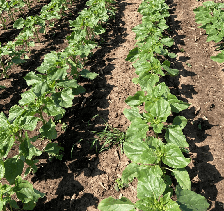
Precision Agriculture
Multispectral imaging drones are widely used in precision agriculture for crop monitoring, health assessment, and yield prediction. By capturing data in multiple spectral bands beyond the visible spectrum (such as near-infrared), these drones can provide insights into plant health, nutrient levels, and water stress. Farmers can use this information to optimize irrigation, fertilizer application, and pest management practices, leading to improved crop yields and resource efficiency.
Environmental Monitoring
Drones equipped with multispectral sensors are valuable tools for environmental monitoring and conservation efforts. They can assess vegetation cover, monitor land use changes, and detect invasive species in sensitive ecosystems. Multispectral data helps environmental scientists track habitat health, biodiversity trends, and ecosystem dynamics, facilitating informed decision-making for land management and conservation initiatives.
Forestry Management
Multispectral imaging drones play a crucial role in forestry management by providing detailed information about forest health, species composition, and tree density. By analyzing multispectral data, foresters can identify areas affected by diseases, pests, or wildfires, and implement targeted intervention strategies. Multispectral technology also supports forest inventory, timber volume estimation, and sustainable forestry practices.
Water Quality Assessment
Drones equipped with multispectral sensors can be used to monitor water bodies and assess water quality parameters such as chlorophyll concentration, turbidity, and algae blooms. Multispectral imagery allows researchers and environmental agencies to detect pollution sources, track nutrient runoff, and identify areas at risk of eutrophication. This information is crucial for effective water resource management and aquatic ecosystem conservation.
Infrastructure Inspection
Multispectral imaging drones are employed for infrastructure inspection tasks, including monitoring of pipelines, power lines, and transportation networks. By capturing multispectral data, drones can detect structural defects, corrosion, and vegetation encroachment that may compromise the integrity and safety of infrastructure assets. Multispectral technology enables early detection of potential issues, minimizing downtime and maintenance costs for critical infrastructure systems.
Natural Resource Management
Multispectral imaging drones support natural resource management initiatives by providing detailed spatial information about land cover, soil properties, and geologic features. Whether assessing mineral deposits, conducting geological surveys, or planning land reclamation projects, multispectral data enhances the efficiency and accuracy of resource exploration and management activities.
Wildlife Conservation
Drones equipped with multispectral sensors are used in wildlife conservation efforts to monitor animal populations, track migration patterns, and assess habitat suitability. Multispectral imagery helps conservationists identify wildlife habitats, monitor endangered species, and combat poaching and illegal logging activities. Drones provide a non-invasive and cost-effective means of conducting aerial surveys in remote or inaccessible areas, contributing to wildlife protection and biodiversity conservation efforts.
Advantages and Limitations
Benefits
1. Vegetation Monitoring: Multispectral imaging can be used to assess vegetation health, identify stressors such as disease or nutrient deficiencies, and optimize agricultural practices such as irrigation and fertilization.
2. Land Use Planning: Multispectral data provides valuable information for land use planning and management, including mapping land cover types, monitoring habitat conditions, and assessing the impact of land development activities.
3. Environmental Monitoring: Multispectral imagery enables the monitoring of environmental variables such as water quality, soil moisture, and pollution levels, supporting efforts to conserve natural resources and protect ecosystems.
4. Precision Agriculture: Multispectral data helps farmers make informed decisions about crop management practices, such as planting, harvesting, and pest control, leading to improved crop yields and resource efficiency.
5. Disaster Response: Multispectral imaging can aid in disaster response and recovery efforts by assessing damage to infrastructure, monitoring changes in landscape conditions, and guiding emergency response teams to affected areas.
Challenges
1. Data Processing Complexity: Multispectral data captured by drones can be voluminous and complex to process. Analyzing and interpreting multispectral imagery require specialized software and expertise, which may pose challenges for users with limited technical skills or resources. Efficient data processing workflows and automation tools are needed to handle large datasets effectively.
2. Calibration and Validation: Ensuring the accuracy and consistency of multispectral data collected by drones is essential for reliable analysis and decision-making. Calibration of sensors, geometric correction, and radiometric normalization are critical steps in ensuring the quality of multispectral imagery. Additionally, validating drone-derived multispectral data against ground truth measurements or satellite imagery can be challenging due to spatial and temporal variability.
3. Weather Dependence: Weather conditions such as clouds, fog, or precipitation can affect the quality and reliability of multispectral data collected by drones. Optical sensors may be sensitive to atmospheric conditions, leading to variations in data quality or incomplete coverage during adverse weather conditions. Ensuring data collection during suitable weather windows and implementing robust quality control measures are essential for mitigating these challenges.
Certifications
- Expert Remote Sensing Training through MAPEO ACADEMY
- Safety equipment


