Skip to content
Toggle Navigation
Industries
Precision Agriculture
Research
Renewable Energy
Utilities
Oil & Gas
Civil Construction
Confined Spaces
Maritime Services
3D Digital Twin & Virtual Tour
Environmental Monitoring
Surveillance and Security
Technologies
LiDAR
Bathymetry
UT
Multispectral
Gas Detection
Thermography
Laser Scanner
GNSS
Ultra-HD Images
Drone in a Box
Blog
Company
About Us
Contact
Career
Terms&Conditions
GDPR Policy
Cookie Policy
Resources
Professional Equipment – La Orizont
Drone Pilot Course – Skyline Academy
let’s talk
Andreea
Client-Focused Leadership Skills
Categories:
Case Study
,
Industry experts
VIDEO – Converting data to the Stereo 70 Romanian National Coordinate System
read more
Categories:
Industry experts
,
LiDAR
,
Trends
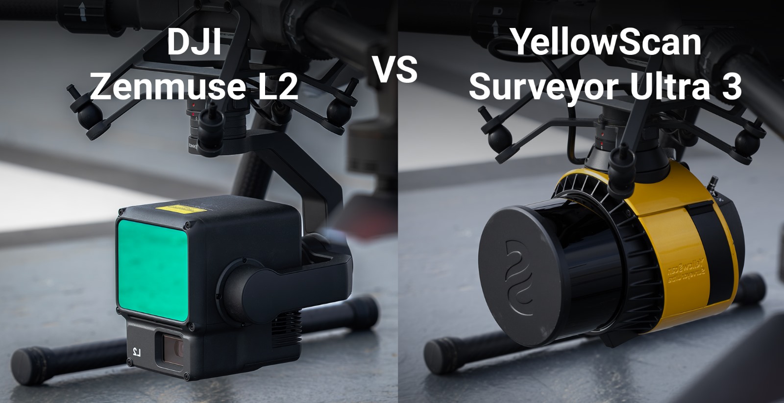
Complete LiDAR system comparison: YellowScan Ultra 3 versus DJI Zenmuse L2
read more
Categories:
Agriculture
,
Industry experts
,
News
Professional AI data analysis software for precision agriculture – News
read more
Categories:
Agriculture
,
Case Study
,
Industry experts
,
News
Case study – use of autonomous drone systems in agricultural theft prevention
read more
Categories:
Industry experts
,
Legislation
,
News
First drone flight – practical and complete guide in 7 steps for beginners
read more
Categories:
Industry experts
,
Trends
Your technical solution for autonomous surveillance and security missions in 2024
read more
Categories:
Industry experts
,
Legislation
,
News
Specific category: How do you know you qualify and what are the steps to take a drone flight in 2024
read more
Categories:
Case Study
,
LiDAR
How can drones with LiDAR systems (as payloads) help you in your field of work? – Introduction
read more
Categories:
Legislation
,
News
EASA Regulations from 1 January 2024 on the classification and operation of drones – Part II – NEW article
read more
Categories:
Industry experts
Case Study: How to get building footprint from point cloud in Stereo 70, EPSG:3844
read more
1
2
Next
Page load link
Go to Top