Skip to content
Toggle Navigation
Industries
Precision Agriculture
Research
Renewable Energy
Utilities
Oil & Gas
Civil Construction
Confined Spaces
Maritime Services
3D Digital Twin & Virtual Tour
Environmental Monitoring
Surveillance and Security
Technologies
LiDAR
Bathymetry
UT
Multispectral
Gas Detection
Thermography
Laser Scanner
GNSS
Ultra-HD Images
Drone in a Box
Blog
Company
About Us
Contact
Career
Terms&Conditions
GDPR Policy
Cookie Policy
Resources
Professional Equipment – La Orizont
Drone Pilot Course – Skyline Academy
let’s talk
Blog
admin
2024-08-20T12:51:19+03:00
All
Agriculture
Case Study
Industry experts
Legislation
LiDAR
News
Oil & Gas
Photovoltaics
Renewable
Thermography
Trends
Wind
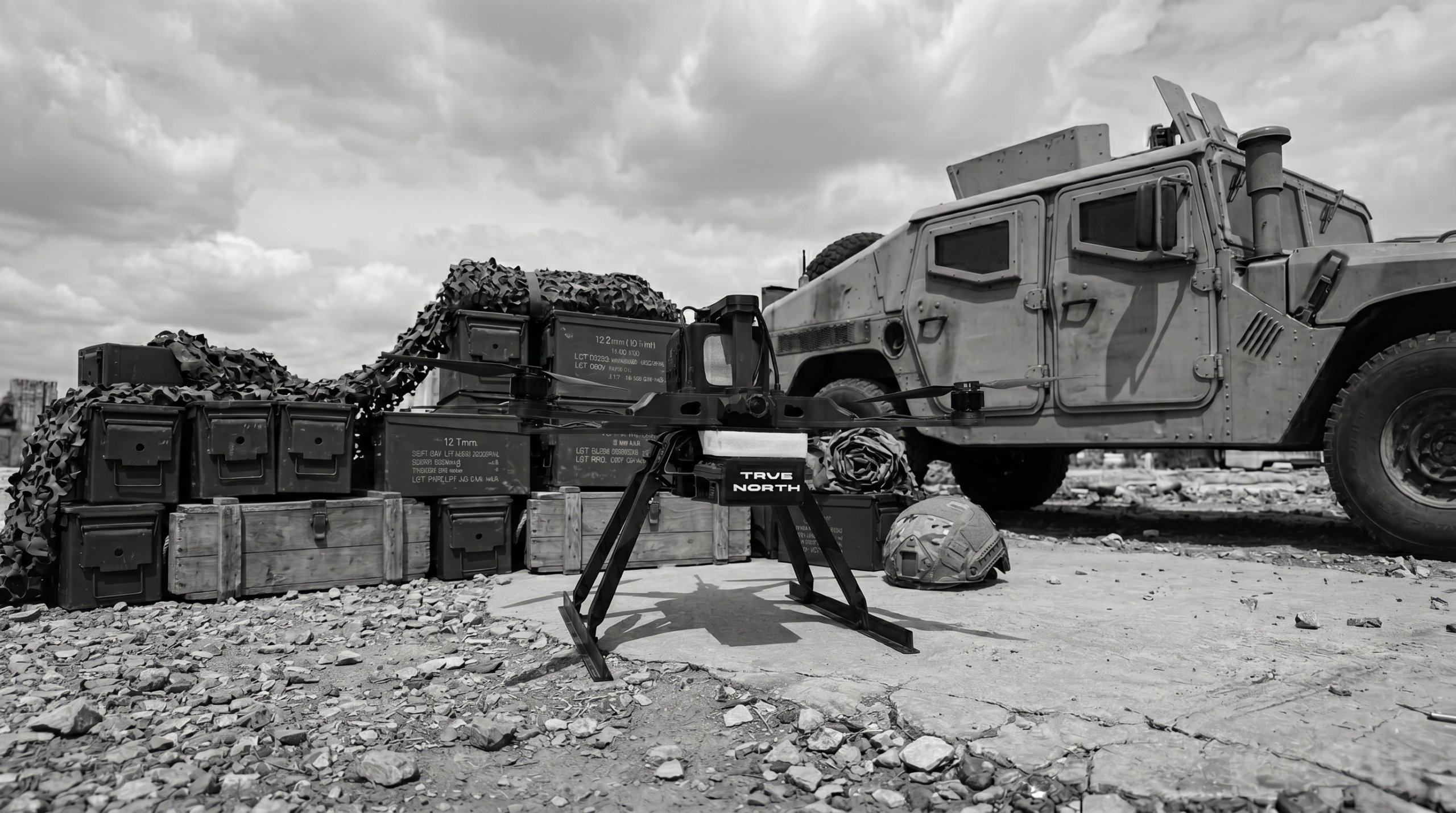
GNSS-Independent Navigation: The True North Approach
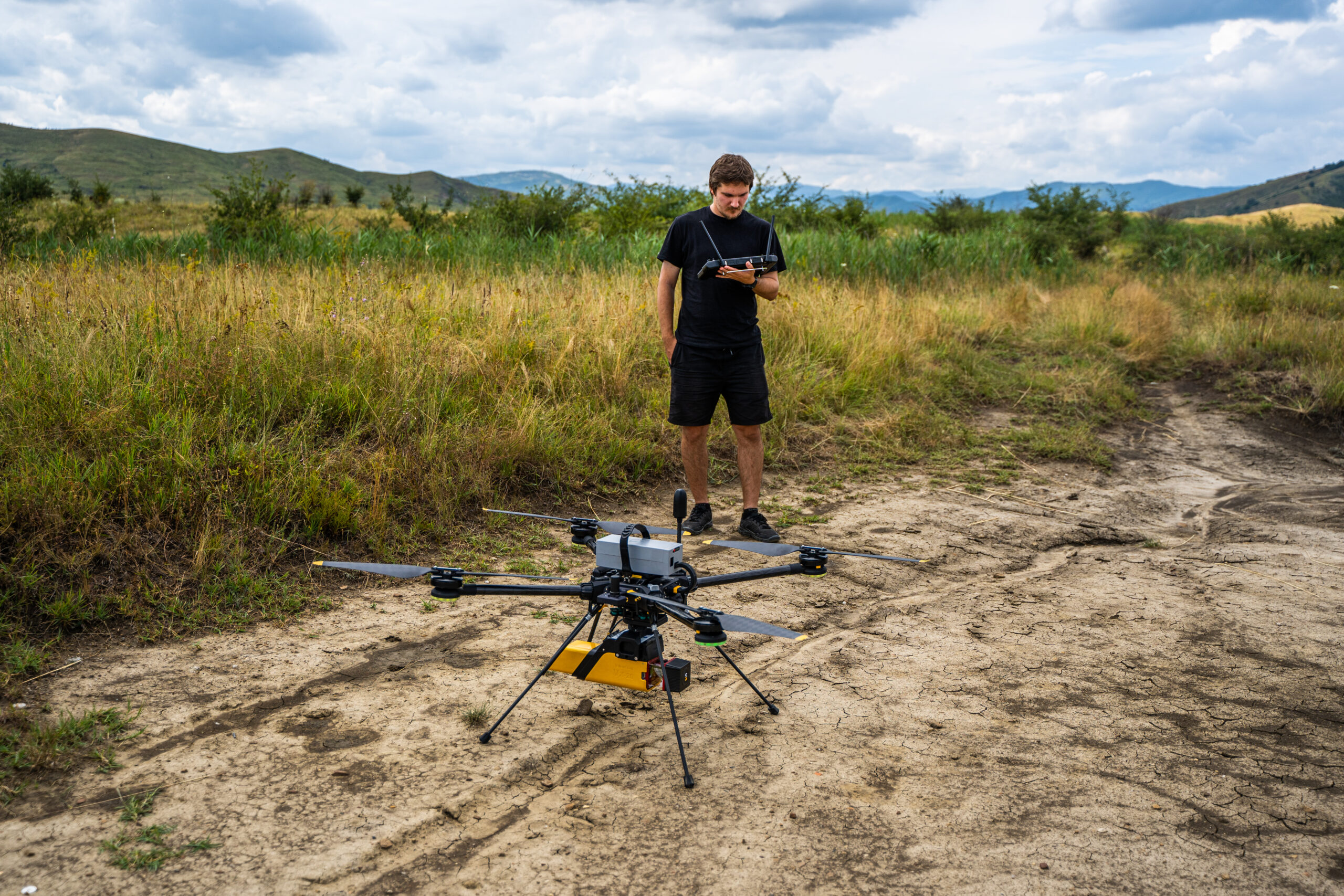
RTK Drones and the 3 cm Accuracy Myth
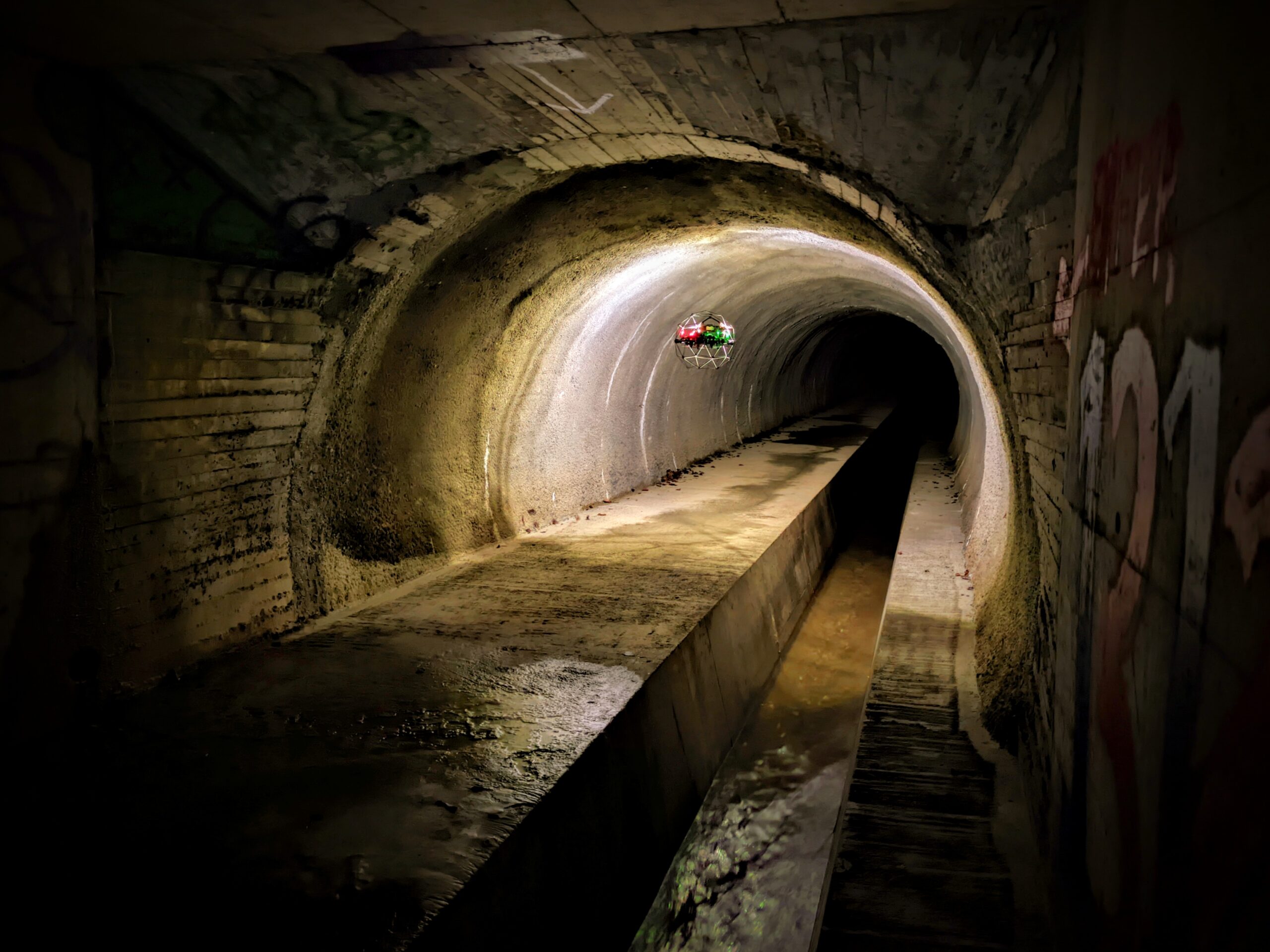
Case Study: Drone Sewer Inspection & 3D Underground Mapping
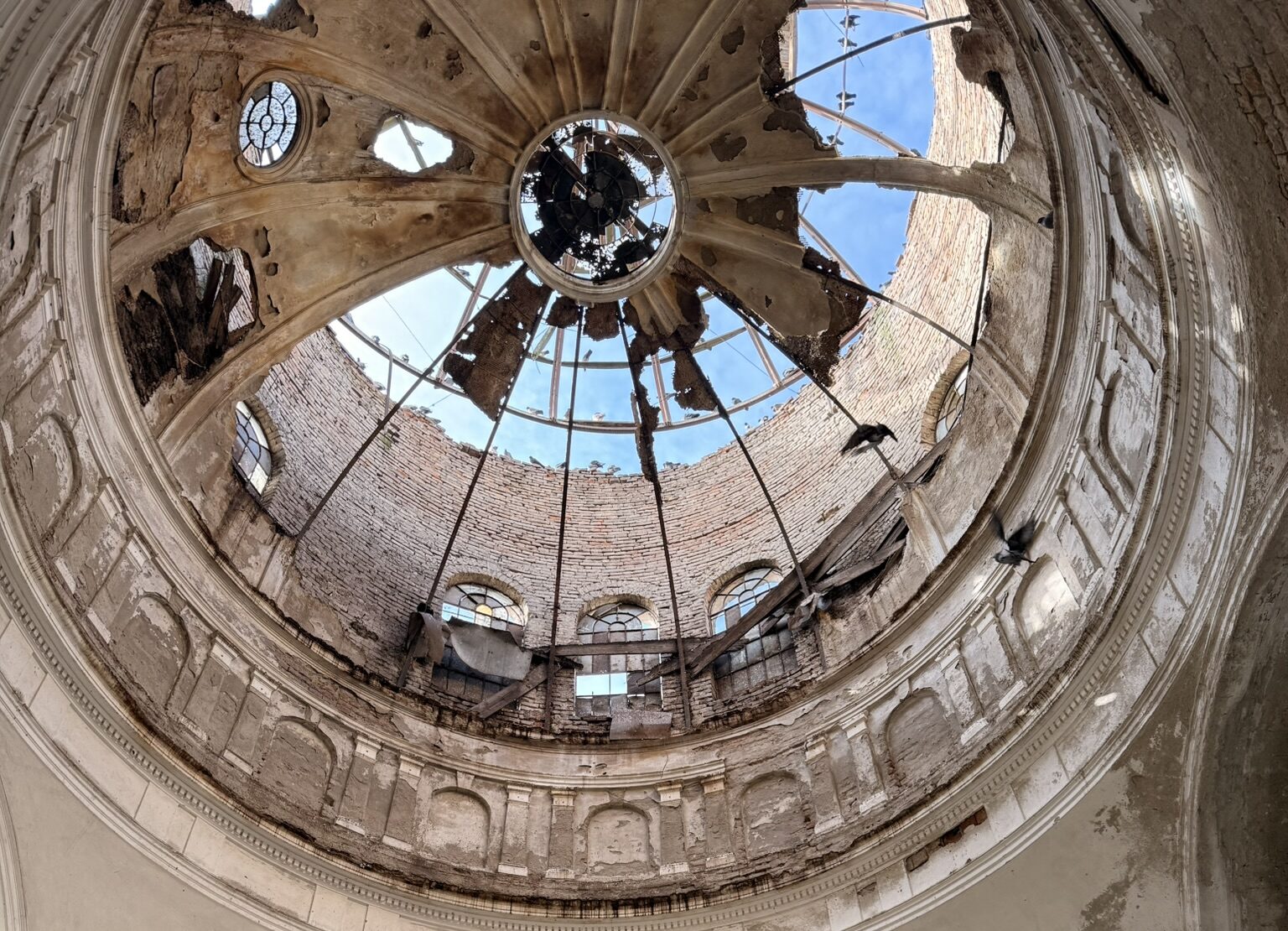
Preserving National Cultural Heritage with UAS. The Bobda Mausoleum Project
Bridging the Gap: A Bathymetric LiDAR Case Study Using YellowScan Navigator
UAS Inspections in Monitoring the Integrity of 37 Cement Silos
Professional UAV Solutions for the Solar Industry’s Growth in 2026
Pilot de drone – o ocupație oficială în România și o profesie în curs de recunoaștere 2025
The first integrated aerial, bathymetric and underwater inspection project in Romania
Underwater inspection for railway infrastructure in Romania – Case Study 2025
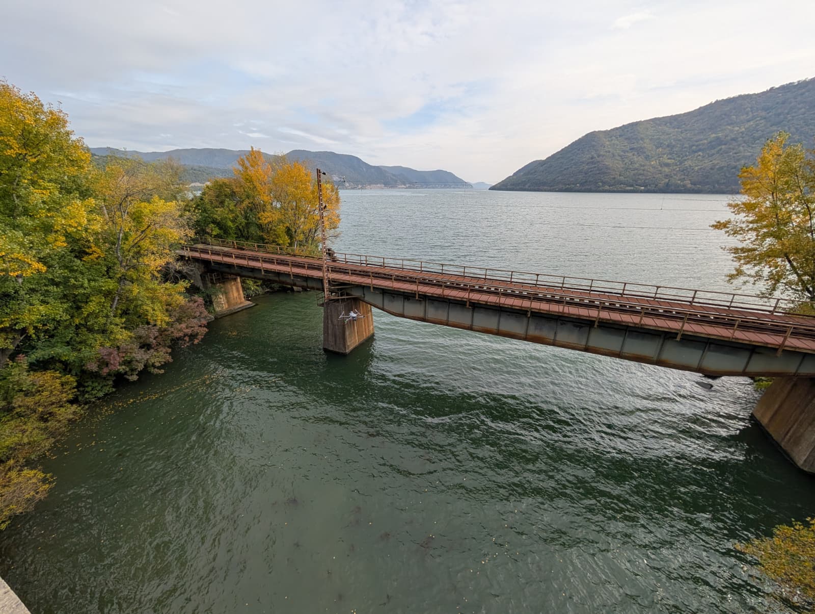
Bathymetric case study for a railway viaduct in Romania 2025
Railway Bridge Full Digital Twin. LiDAR & RGB Inspection Case Study 2025
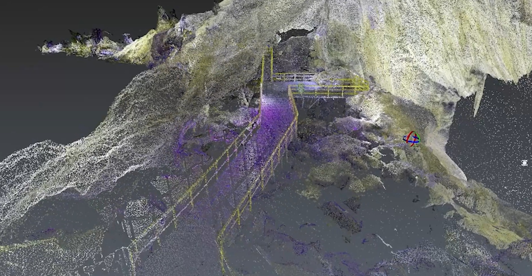
Morphometric Analysis of Ialomița Cave Using TLS and Drone-Based SLAM LiDAR
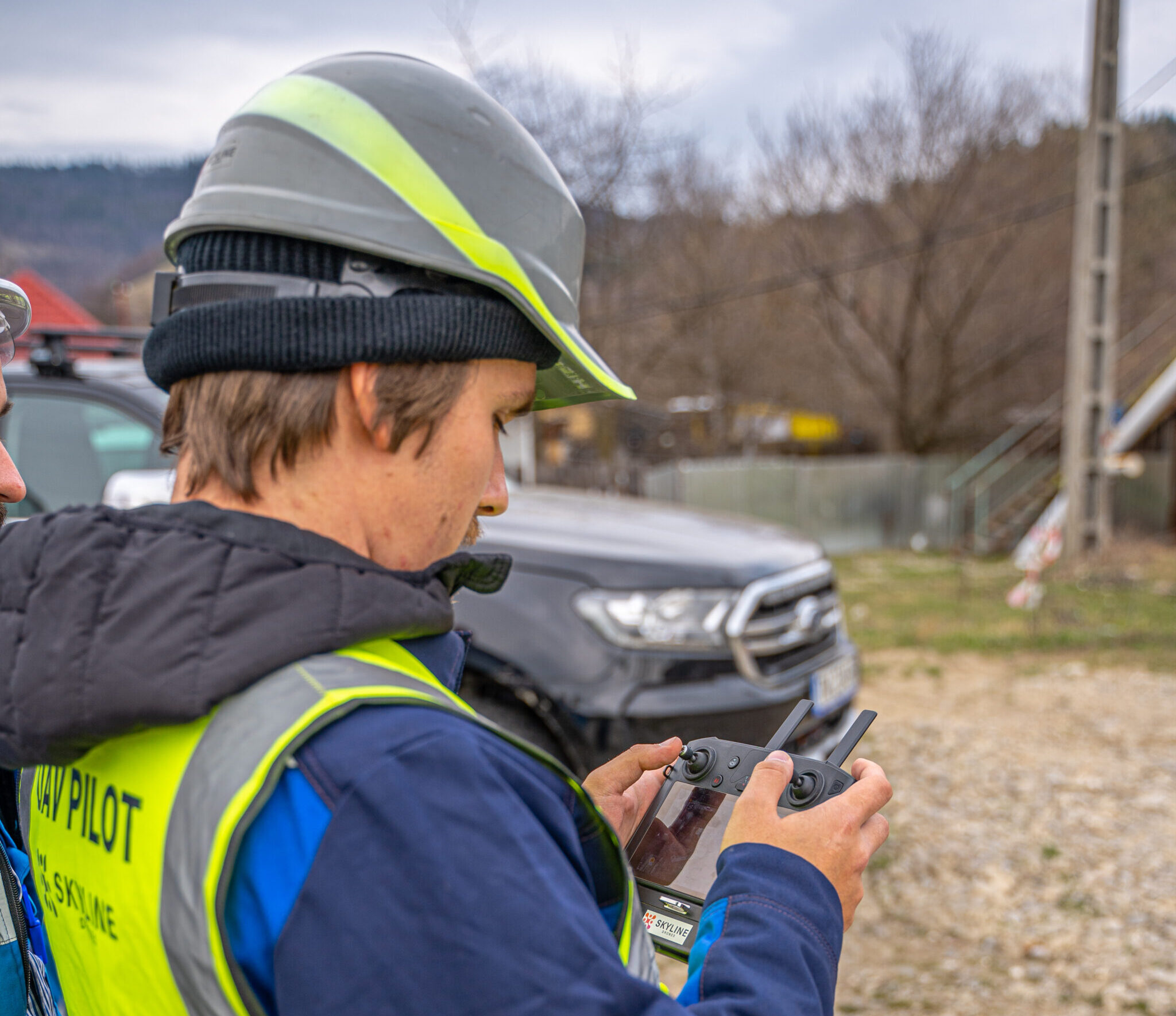
How do we choose the right flight category for professional UAV missions?
What can professional ROVs do? Practical applications with QYSEA W6 and E-Master
Inspection of sewers with Elios 3
1
2
Next
Load More Posts
All
Agriculture
Business
Business Relations
Case Study
Industry experts
Legislation
LiDAR
News
Oil & Gas
Photovoltaics
Renewable
Strategy
Thermography
Trends
Uncategorized
Wind
GNSS-Independent Navigation: The True North Approach
Gallery
GNSS-Independent Navigation: The True North Approach
RTK Drones and the 3 cm Accuracy Myth
Gallery
RTK Drones and the 3 cm Accuracy Myth
Case Study: Drone Sewer Inspection & 3D Underground Mapping
Gallery
Case Study: Drone Sewer Inspection & 3D Underground Mapping
Preserving National Cultural Heritage with UAS. The Bobda Mausoleum Project
Gallery
Preserving National Cultural Heritage with UAS. The Bobda Mausoleum Project
Bridging the Gap: A Bathymetric LiDAR Case Study Using YellowScan Navigator
Gallery
Bridging the Gap: A Bathymetric LiDAR Case Study Using YellowScan Navigator
UAS Inspections in Monitoring the Integrity of 37 Cement Silos
Gallery
UAS Inspections in Monitoring the Integrity of 37 Cement Silos
Professional UAV Solutions for the Solar Industry’s Growth in 2026
Gallery
Professional UAV Solutions for the Solar Industry’s Growth in 2026
Pilot de drone – o ocupație oficială în România și o profesie în curs de recunoaștere 2025
Gallery
Pilot de drone – o ocupație oficială în România și o profesie în curs de recunoaștere 2025
The first integrated aerial, bathymetric and underwater inspection project in Romania
Gallery
The first integrated aerial, bathymetric and underwater inspection project in Romania
Underwater inspection for railway infrastructure in Romania – Case Study 2025
Gallery
Underwater inspection for railway infrastructure in Romania – Case Study 2025
Bathymetric case study for a railway viaduct in Romania 2025
Gallery
Bathymetric case study for a railway viaduct in Romania 2025
Railway Bridge Full Digital Twin. LiDAR & RGB Inspection Case Study 2025
Gallery
Railway Bridge Full Digital Twin. LiDAR & RGB Inspection Case Study 2025
Morphometric Analysis of Ialomița Cave Using TLS and Drone-Based SLAM LiDAR
Gallery
Morphometric Analysis of Ialomița Cave Using TLS and Drone-Based SLAM LiDAR
How do we choose the right flight category for professional UAV missions?
Gallery
How do we choose the right flight category for professional UAV missions?
What can professional ROVs do? Practical applications with QYSEA W6 and E-Master
Gallery
What can professional ROVs do? Practical applications with QYSEA W6 and E-Master
Inspection of sewers with Elios 3
Gallery
Inspection of sewers with Elios 3
1
2
Next
Page load link
Go to Top