
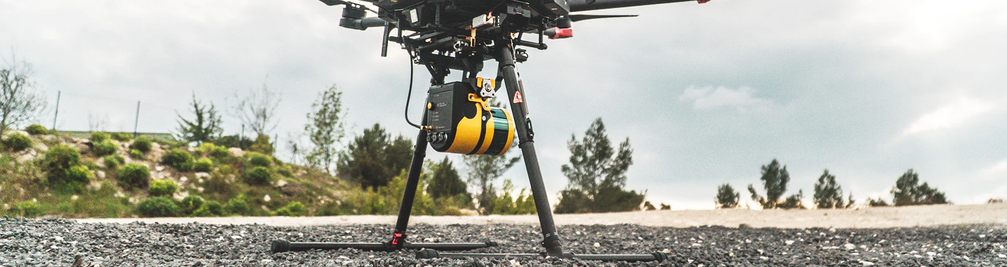
YellowScan Fly and Drive is a LiDAR remote sensing system that can be used on both vehicles and drones (UAVs), offering geospatial scanning from both the ground and the air. Collecting geo-referenced point clouds with Fly & Drive is done by combining high-resolution laser scanning (point clouds) with precise positioning (trajectory).

The system has a built-in GNSS antenna for the best positioning accuracy, LiDAR unit with a special design created for maximum compatibility with mounting on vehicles and drones (UAVs) and very easy change, aluminum chassis and a fiberglass pod that gives it aerodynamics.
Key benefits of the YellowScan Fly and Drive LiDAR system
• Portable with low power consumption. Can be installed on all types of drones (UAVs) and vehicles;
• Precise positioning using the latest generation integrated GNSS and IMU system;
• Robust and reliable system;
• High-frequency laser scanner that allows good productivity without compromising the density of point clouds;
• Mobile remote sensing system (ground) and drones (air).
Technical information Fly & Drive
YellowScan Fly and Drive can be integrated with multi-rotor drones, fixed-wing drones and vehicles. The maximum recommended speed for the car is 50 km/h and the suitable speed for UAV scans is 18 m/s. The package contains the LiDAR unit (Surveyor Ultra), a pod (detachable unit) for the car and a UAV mounting bracket.
The system has centimeter precision and accuracy, and the scanner model is Hesai XT32M2X. The GNSS solution uses the Applanix APX-15 UAV for the best georeferencing of data.
| Technical information Fly & Drive | |
| Precision | 3 cm |
| Accuracy | 3 cm |
| Typ. driving speed | 25-50 km/h |
| Typ. flight speed | 18 m/s |
| Typ. AGL altitude | 90 m |
| Range | Surveyor Ultra: up to 140 m |
| Scanner | Surveyor Ultra: Hesai XT32M2X |
| GNSS-Inertial solution | Surveyor Ultra: Applanix APX-15 UAV |
| Echoes per shot | Surveyor Ultra: up to 3 |
| Shots per second | Surveyor Ultra: up to 640k |
| Weight | Surveyor Ultra: 1.3 kg battery incl. |
| Size | Surveyor Ultra: L 16 x W 10.3 x H 13.8 cm |
| Autonomy | Surveyor Ultra: 1.2 hour typ. |
| Power consumption | Surveyor Ultra: 22 W |
| Operating temperature | Surveyor Ultra: -10 up to +40°C |
Classification of laser systems according to safety level
For safety reasons, laser systems are classified by their potential risk of causing eye and skin damage. The classification is made according to the wavelength used (i.e. color), according to the power and emission mode of the laser which can be pulsed or continuous.
Manufacturers are required by law to state the safety class of the product that uses laser technology and this will appear on the product written either in Arabic or Roman numerals.
According to European legislation, laser systems are classified into 7 classes, as can be seen in the image below: 1, 1M, 2, 2M, 3R, 3B, 4. Class 1 is the safest class, specifying that the products does not present any danger to the user under normal conditions of use. Products in this class use wavelengths of the laser beam that can be seen with the naked eye without causing eye problems.
As can be seen in the image below, laser beams are skin safe up to class 2M, with classes 3R and 3B being skin safe under special conditions. Eye injuries can instead be caused by beams belonging to classes 3R and 3B, with classes 1-2M requiring eye protection for safety. Class 4 laser systems contain light beams at wavelengths that cause skin and eye damage.
The YellowScan Fly & Drive LiDAR system is class 1, being both eye and skin safe.

Classification and properties of LiDAR systems
© YellowScan 2021
Product demonstration
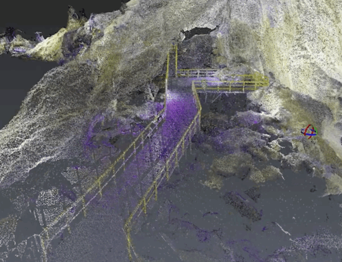
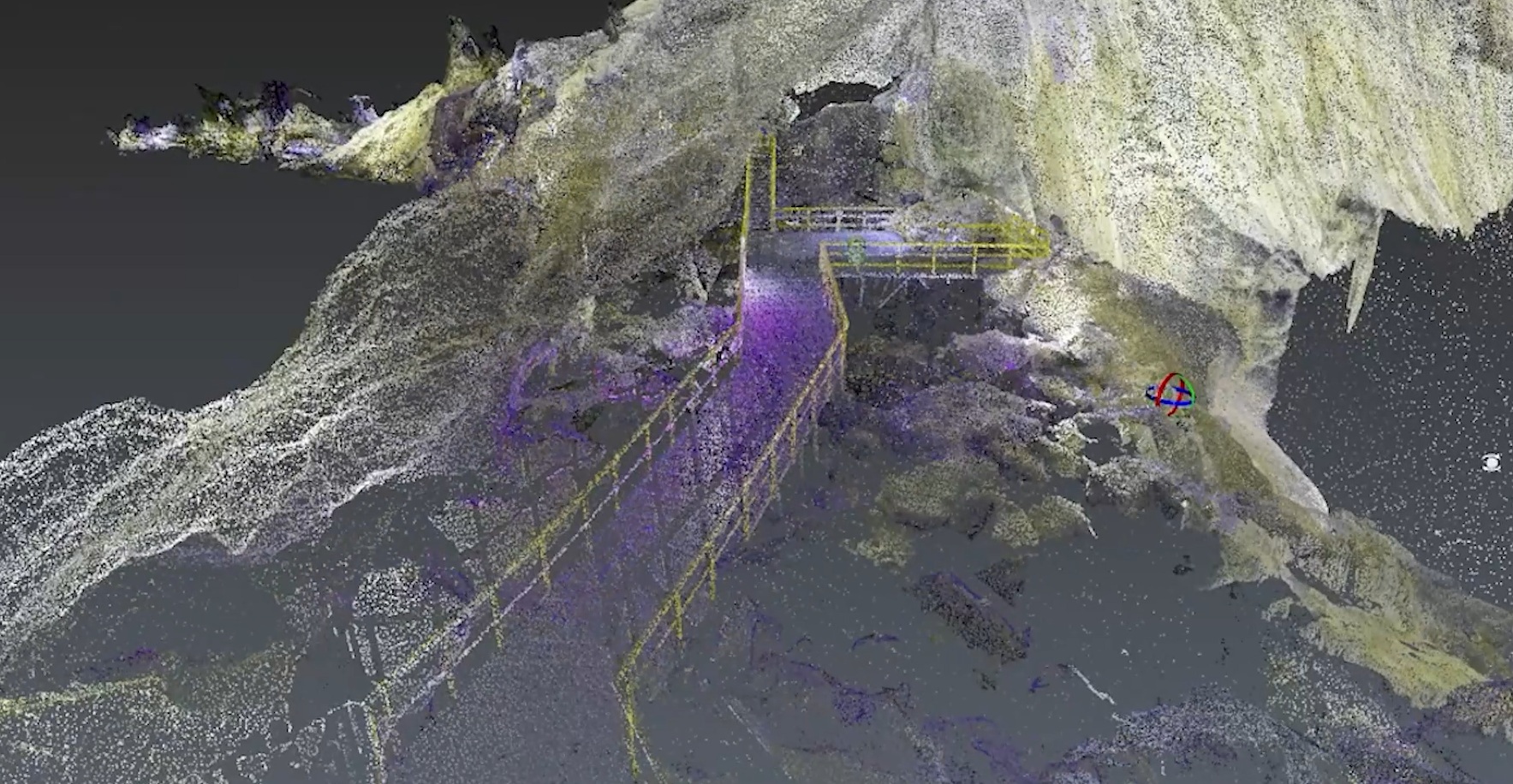
Acquiring drone data is extremely easy and fast, but what happens when the scanning project includes urban areas where obtaining flight clearances is more difficult or even impossible? YellowScan Fly & Drive is the solution that allows data acquisition even in areas where flying is restricted.
The video material below contains the use of the Fly & Drive system on a concrete example, namely the scanning of an area that contains both land with vegetation and the urban area.
For the vegetation area, the LiDAR was mounted on a DJI Matrice 600 drone, and for the urban area, the system was mounted on a car and the scanning was done from the ground.
Duration: 6 minutes.
La Orizont is the official and exclusive distributor in Romania for YellowScan products. For the offer, details or any other questions, contact us at phone number +40 724 339 757, at the e-mail address ciprian.iorga@skylinedrones.ro or through this form.


