
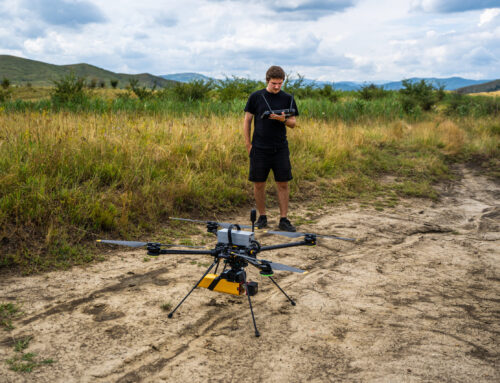
1. Introduction and Speleological Context
The Ialomița Cave, located in the Bucegi Mountains of Romania, represents one of the most significant underground landmarks with cultural, scientific, and touristic value. Conducting a morphometric analysis of caves provides essential insights into their structure, volume, and geomorphological evolution. Recent advancements in LiDAR scanning technologies have enabled researchers to capture highly detailed 3D models of complex underground environments, supporting both scientific research and heritage preservation.
2. Methodology
Terrestrial Laser Scanning (TLS) in Caves
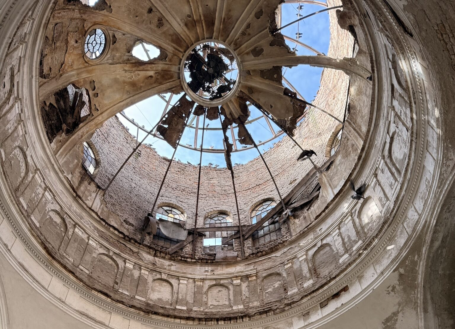
Terrestrial Laser Scanning (TLS) was deployed to acquire high-resolution point clouds of the cave’s interior. This technique ensures millimetric accuracy and allows for detailed cross-sectional and volumetric measurements, crucial for morphometric studies.
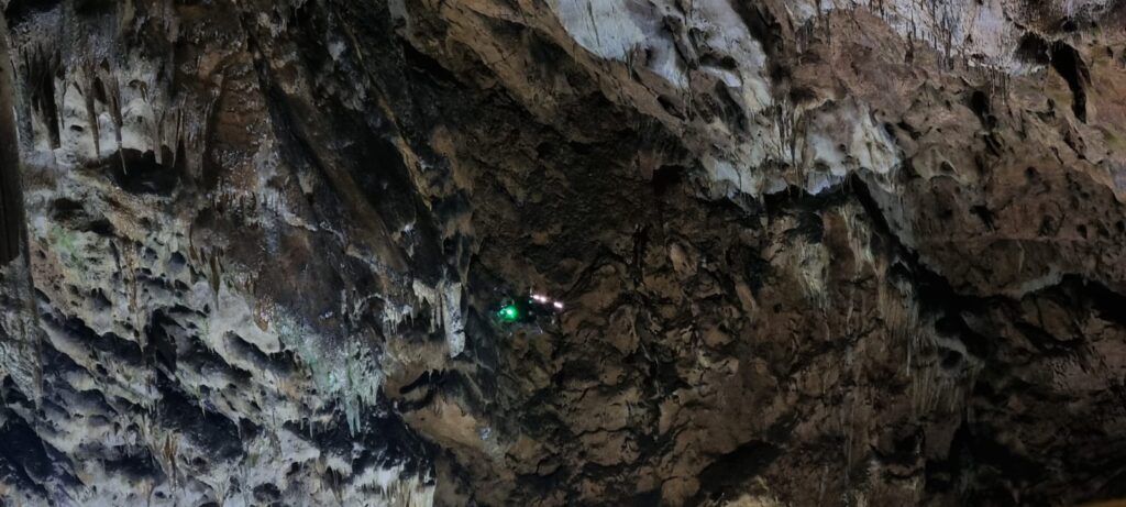
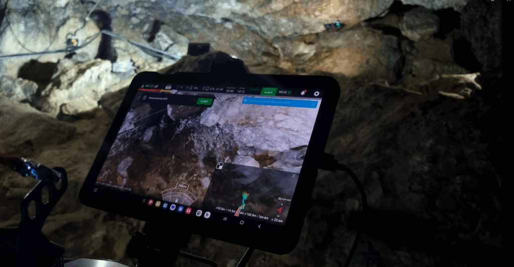
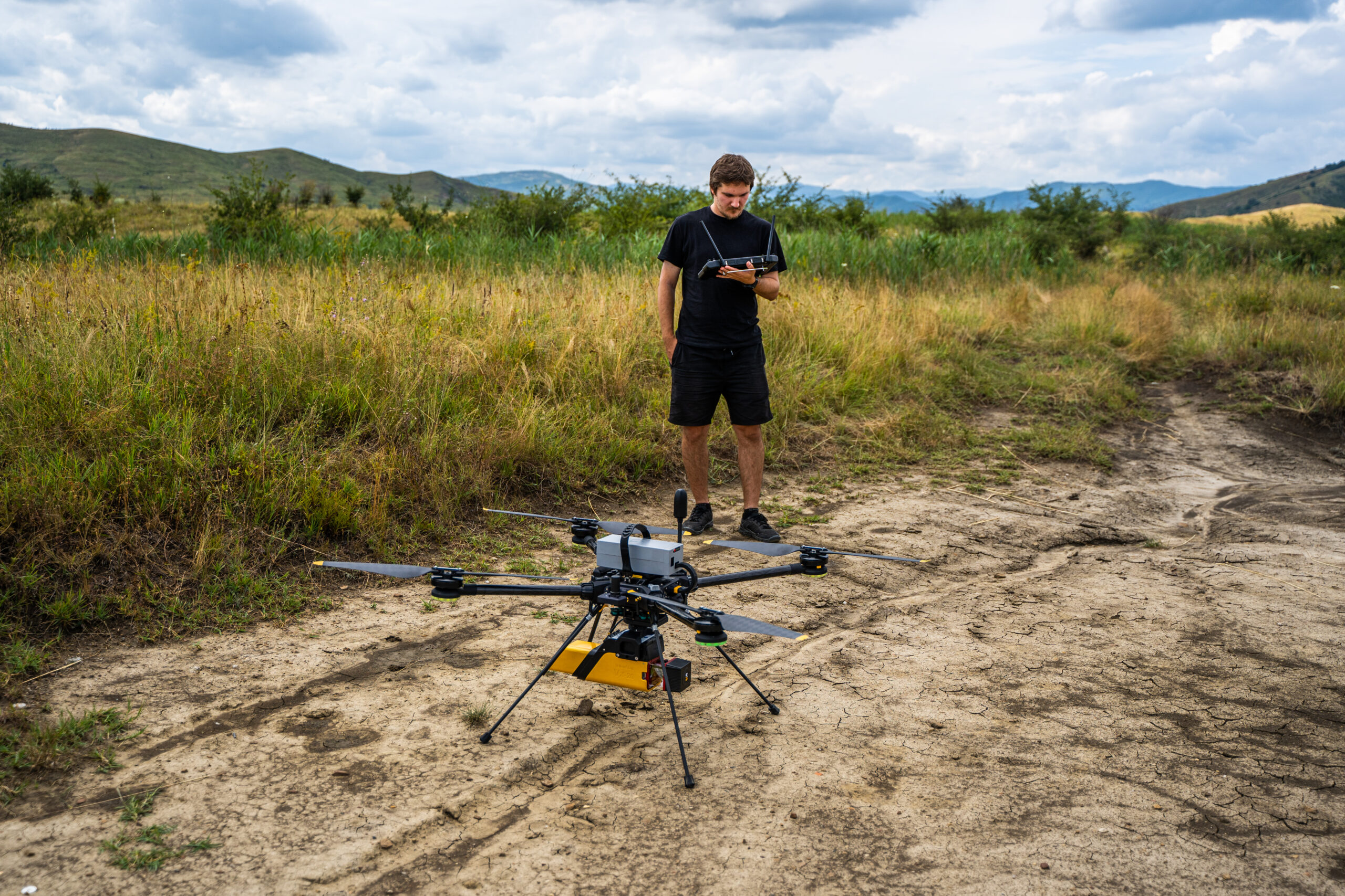
Drone-Based SLAM LiDAR
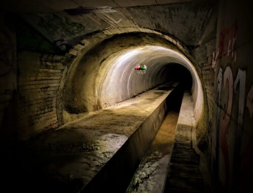
In sections where accessibility was limited, a drone equipped with SLAM LiDAR technology was used. SLAM (Simultaneous Localization and Mapping) enables mapping in GPS-denied environments, such as caves, ensuring continuous data collection along narrow passages and vertical shafts
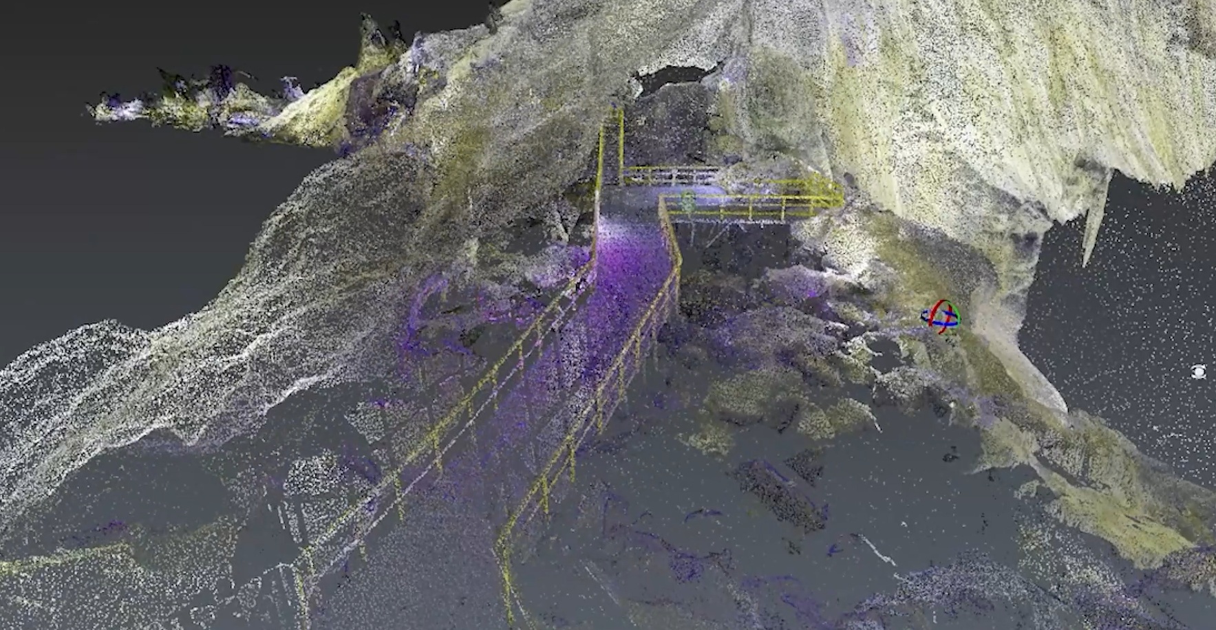
3. Results and Outputs
3D Cave Models and Cross-Sections
The resulting 3D model provides a detailed representation of the cave’s morphometry, supporting volumetric and geomorphological analyses, as well as research on geological structures, paleoclimate archives, and the cave’s vulnerability to environmental change.
Morphometric and Volumetric Analyses
Morphometric parameters such as passage length, volume, and slope gradients were extracted from the 3D model. These metrics are essential for:
-
evaluating structural stability,
-
understanding hydrological pathways,
-
and planning conservation strategies.
4. Applications and Implications
Heritage Conservation and Cave Management
The accurate 3D reconstruction supports heritage conservation efforts, allowing specialists to monitor changes in cave morphology over time. Authorities can use these datasets for sustainable management, hazard assessment, and infrastructure planning.
Virtual Tourism and Educational Use
High-resolution models enable the development of virtual cave tours, bringing speleological wonders closer to the public. Educational institutions can integrate these models into digital learning platforms, enhancing scientific outreach.
Challenges and Limitations
-
Limited GNSS coverage within cave interiors required extensive reliance on SLAM algorithms.
-
High humidity and irregular surfaces occasionally introduced point cloud noise.
-
Integrating multiple datasets demanded significant post-processing efforts.
5. Conclusions and Future Work
The morphometric analysis of Ialomița Cave using TLS and drone-based SLAM LiDAR demonstrates the efficiency of modern scanning technologies in speleology. The study highlights the potential of LiDAR for heritage preservation, scientific research, and immersive tourism experiences. Future work will focus on extending surveys to adjacent cave systems and improving automated data processing for morphometric parameter extraction.
Beyond its scientific applications, the dataset contributes to the development of a new information culture, essential for processing both quantitative and qualitative data about the subterranean environment. This environment is not only fragile and vulnerable but also remarkably rich in natural archives paleoclimatic, fossil, ecological, anthropological, hydrogeological, and many others.
6. Acknowledgments
The collaboration between the National Institute for Earth Physics, the Romanian Academy – Emil Racoviță Institute of Speleology, and Skyline Drones, with the support of the Curtea Domnească National Museum Complex in Târgoviște and Topgeocart, made this study possible.

