Skip to content
Skyline Drones Logo
  • Industries
    • Precision Agriculture
      • Research Projects
    • Renewable Energy
    • Utilities
    • Oil and Gas
    • Civil Construction
    • Confined Spaces
    • 3D Digital Twin and Virtual Tour
    • Environmental Monitoring
    • Surveillance and Security
  • Technologies
    • LiDAR
    • Bathymetry
    • UT
    • Multispectral
    • Gas Detection
    • Thermography
    • Laser Scanner
    • GNSS
    • Ultra-HD Images
    • Drone in a Box
  • Blog
  • Company
    • About Us
    • Contact
    • Career
  • Resources
    • Buy Professional Equipment – La Orizont
    • Become a drone pilot – Skyline Academy
let’s talk

LiDAR

Client-Focused Leadership Skills

  • 3D model of Ialomița Cave generated using TLS and drone-based SLAM LiDAR
    Categories: Case Study, Industry experts, LiDAR, Uncategorized

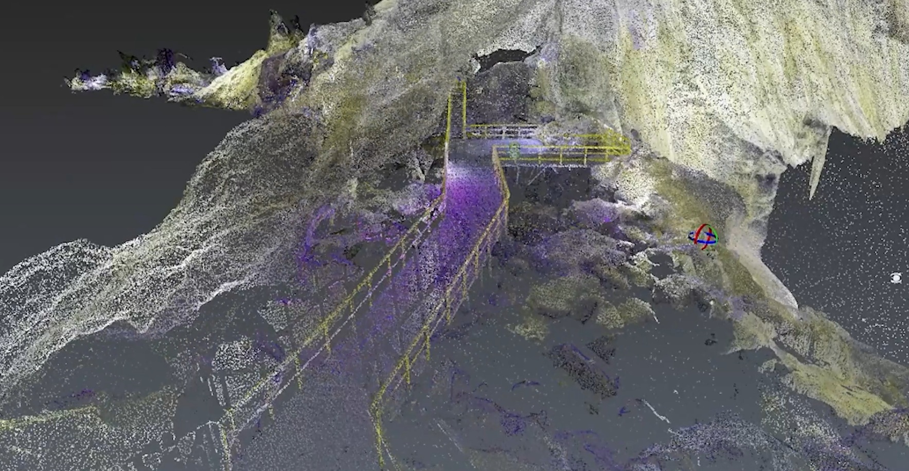
    Morphometric Analysis of Ialomița Cave Using TLS and Drone-Based SLAM LiDAR

    read more
  • Categories: Trends, Case Study, LiDAR

    Inspection of sewers with Elios 3

    read more
  • Categories: Industry experts, LiDAR

    Maximize ship inspection efficiency with UAVs

    read more
  • Skyline Drones Announces New Partnership with Atis Cloud
    Categories: Business, Business Relations, Industry experts, LiDAR, News, Trends

    Skyline Drones Announces New Partnership with Atis Cloud

    read more
  • Carierei Roșia Poieni
    Categories: Case Study, Industry experts, LiDAR, News, Thermography, Uncategorized

    Cuprumin 2024 – Revolutionizing Quarry Mapping: Cutting-Edge LiDAR Scanning at Roșia Poieni and Geamăna Tailings

    read more
  • Navigating the Depths: A Comparison Between Z-Boats and YellowScan Navigator for Professional Drone Services
    Categories: LiDAR, Case Study, Industry experts

    Navigating the Depths: A Comparison Between Z-Boats and YellowScan Navigator for Professional Drone Services

    read more
  • Categories: Industry experts, LiDAR, Trends

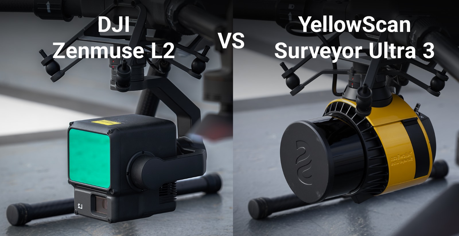
    Complete LiDAR system comparison: YellowScan Ultra 3 versus DJI Zenmuse L2

    read more
  • Point cloud result from LiDAR
    Categories: Case Study, LiDAR

    How can drones with LiDAR systems (as payloads) help you in your field of work? – Introduction

    read more

keep updated & don’t miss anything!

Stay up-to-date with drone news or get inspired by our drone use cases.

Thank you for your message. It has been sent.
There was an error trying to send your message. Please try again later.
Home Page
Industries

Precision Agriculture

Renewable Energy

Utilities

Oil & Gas

Civil Construction

Confined Spaces

3D Digital Twin & Virtual Tour

Environmental Monitoring

Surveillance & Security


Technologies

LiDAR

UT

Multispectral

Gas Detection

Thermography

Laser Scanner

GNSS

Ultra HD Images

Drone in a box

Company

About Us

Career

Contact

Blog

Buy professional equipment – La Orizont

Become a drone pilot – Skyline Academy

Contact

office@skylinedrones.ro

+40 724 339 757

Monday to Friday : 9 am – 5 pm

2026 Skyline Drones All Rights Reserved

Page load link
  • Industries
    • Precision Agriculture
      • Research Projects
    • Renewable Energy
    • Utilities
    • Oil and Gas
    • Civil Construction
    • Confined Spaces
    • 3D Digital Twin and Virtual Tour
    • Environmental Monitoring
    • Surveillance and Security
  • Technologies
    • LiDAR
    • Bathymetry
    • UT
    • Multispectral
    • Gas Detection
    • Thermography
    • Laser Scanner
    • GNSS
    • Ultra-HD Images
    • Drone in a Box
  • Blog
  • Company
    • About Us
    • Contact
    • Career
  • Resources
    • Buy Professional Equipment – La Orizont
    • Become a drone pilot – Skyline Academy

Contact us:

+40 724 339 757

ciprian.iorga@skylinedrones.ro
Monday to Friday : 9:00 am – 5:00 pm
Go to Top