
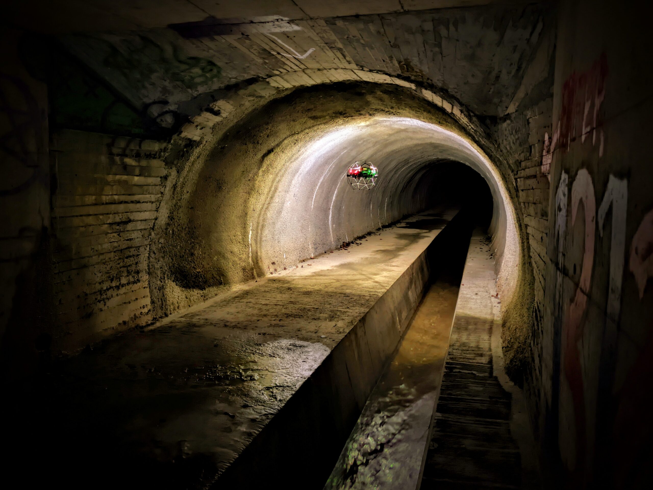
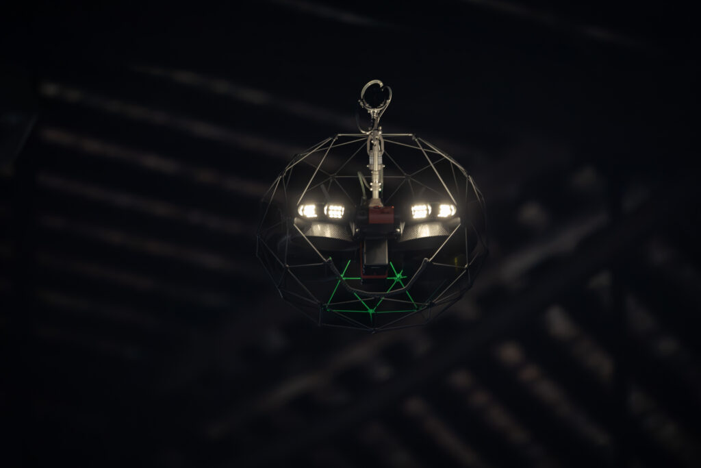
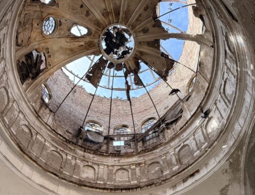
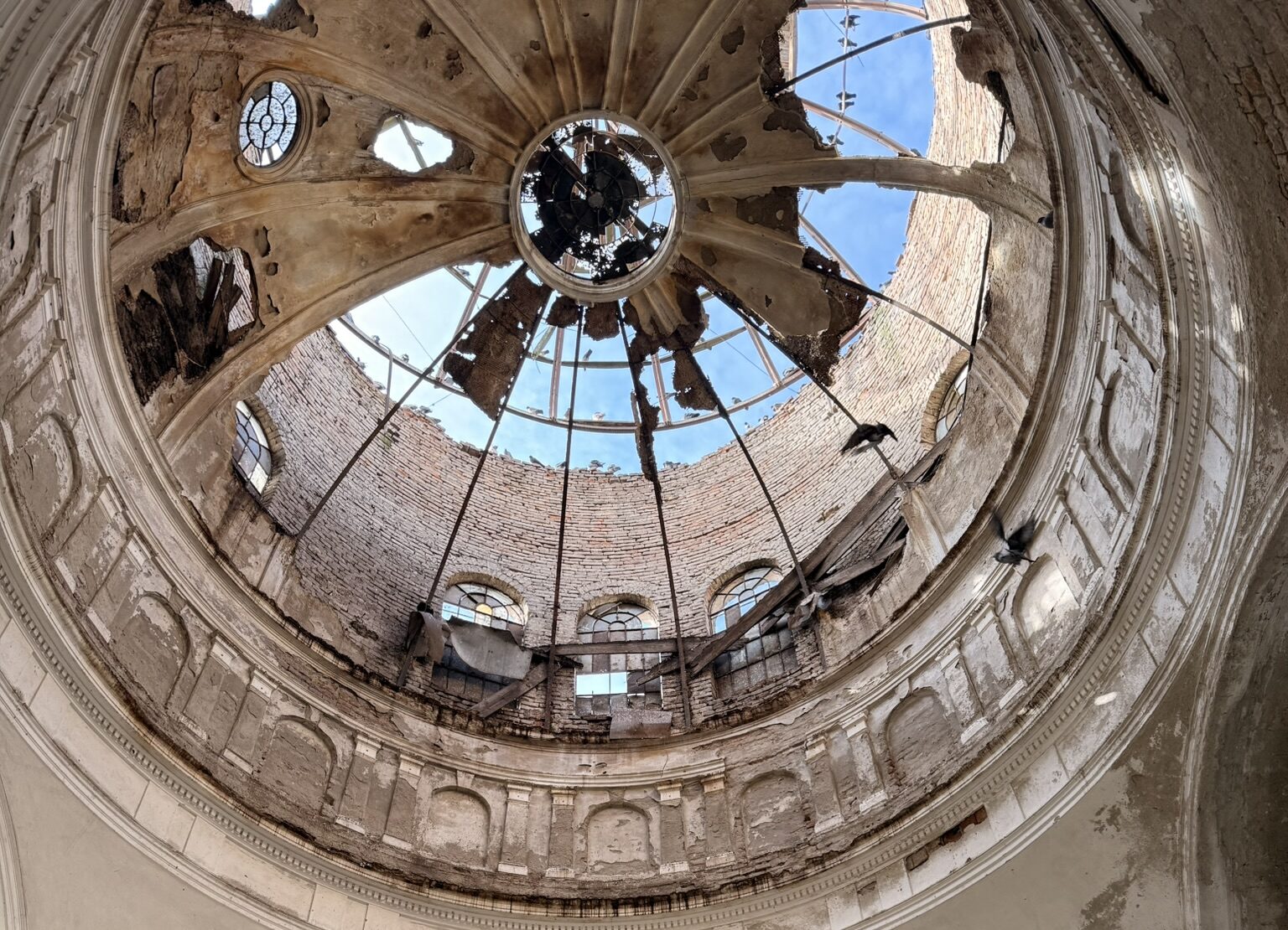
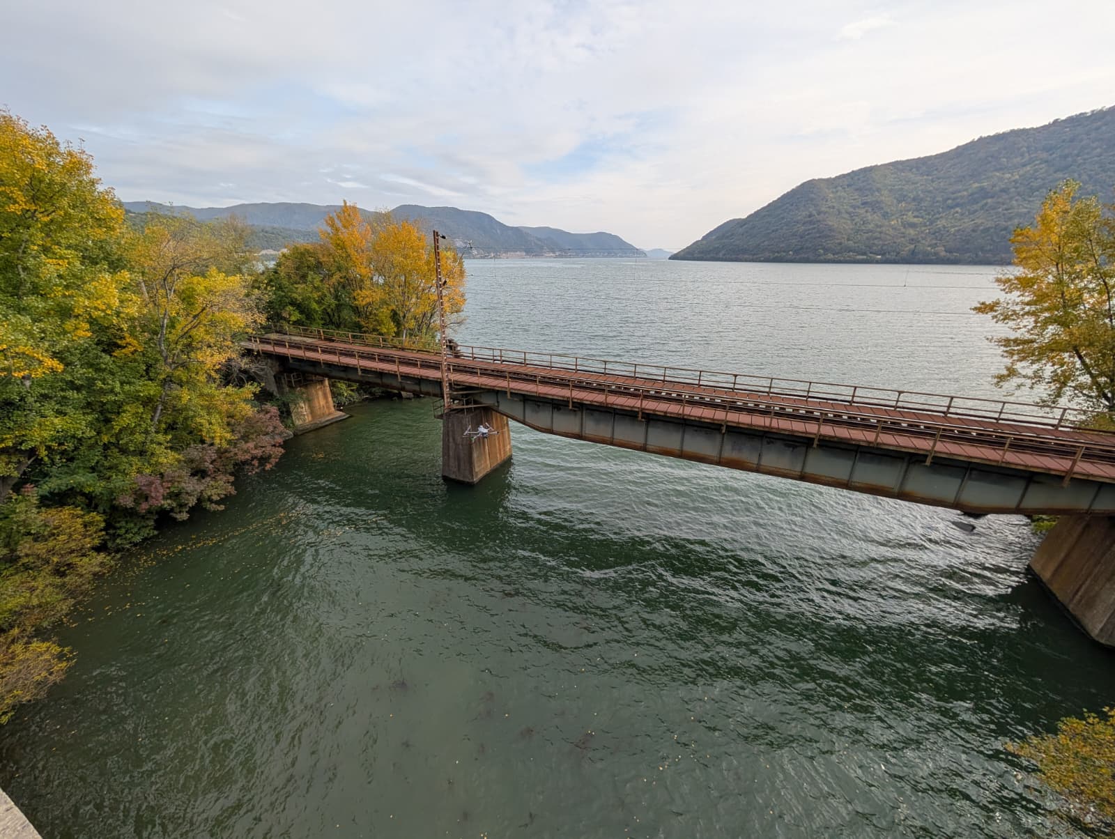
A technical inspection of several sewer collectors and a large underground chamber was recently carried out using a modern method that replaces traditional manual checks. The project used a special drone designed for confined spaces that can fly without a GPS signal. Equipped with LiDAR and cameras, the drone used SLAM technology to create an point cloud of the entire underground structure.
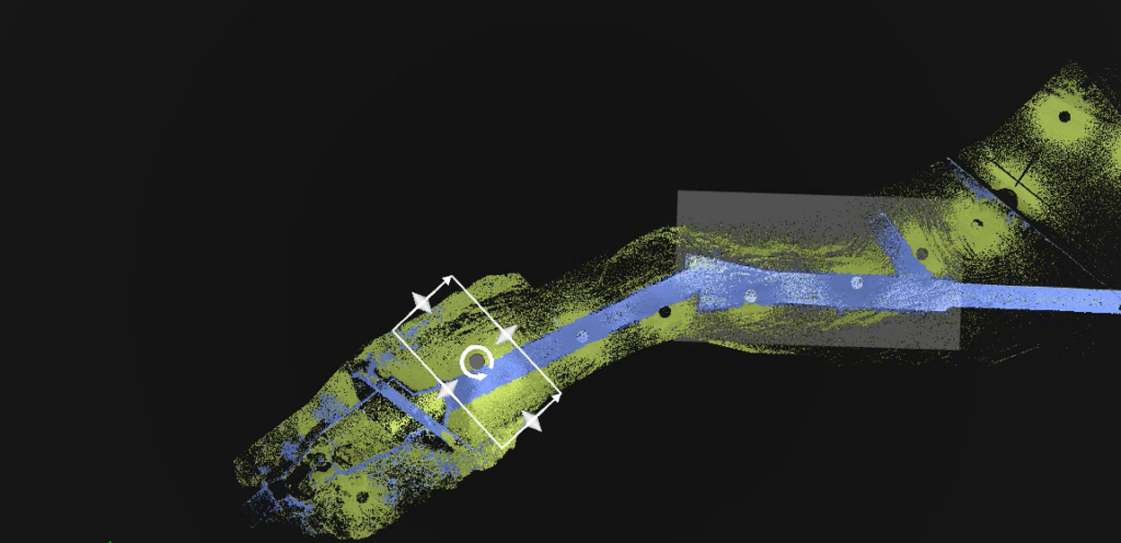
A key part of this project was combining the underground data with a scan of the surface. The point cloud created by the drone inside the sewer was merged with a high-precision laser scan taken at street level. This provides a complete picture, showing exactly where the underground pipes run in relation to the roads and buildings above. This integrated view is incredibly useful for planning future work, making repairs more efficient, and preventing accidents during excavation.
Maintaining underground infrastructure is a major challenge for city planners and engineers. Traditional methods for checking sewer lines often involve sending human workers into dangerous, confined spaces. This case study explores a modern, highly efficient alternative: using drone sewer inspection combined with surface-level 3D scanning to create a complete digital map of underground assets.
By using advanced LiDAR technology and specialized indoor drones, this project successfully mapped a network of sewer collectors and a large underground chamber, providing a seamless link between the hidden underground world and the surface above.
The Project Workflow. Drone sewer inspection
To capture accurate data without putting human teams at risk, the project followed a strict, three-step workflow designed to map both the interior of the sewers and the exterior surface.
Phase 1: Underground data capture
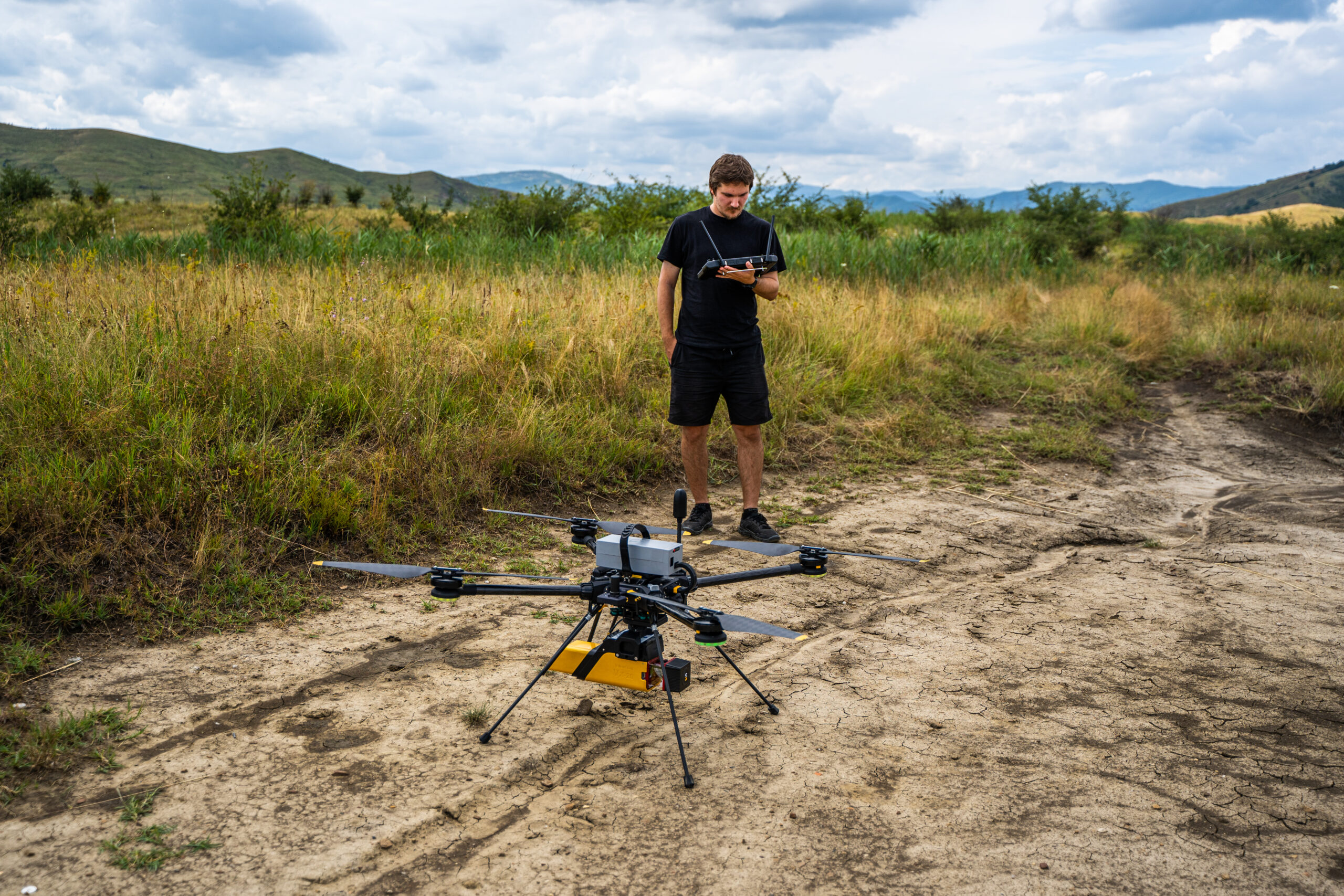
The process began with a specialized indoor drone designed to fly safely in confined spaces without a GPS signal. As the drone navigated the sewer collectors, it simultaneously gathered two types of data: high-definition video and LiDAR (laser) scans.
Phase 2: Surface 3D scanning
While the drone mapped the underground area, a high-precision terrestrial laser scanner (TLS) was deployed at ground level. This scanner captured the exact layout of the surface environment directly above the sewer lines, including roads, buildings, and access points.
Phase 3: Data processing and correlation
The final and most important step was aligning the two sets of data. The 3D point cloud generated by the drone inside the sewer was merged with the surface point cloud. This correlation accurately positioned the underground structures in relation to the surface landmarks, creating a unified 3D underground mapping model.
Types of Inspections Conducted
The project relied on two main types of inspection activities to ensure a thorough technical diagnosis:
3.1 Visual inspection
-
Video capture: The drone recorded high-quality video along the entire route of the sewer collectors. This allows engineers to visually inspect the condition of the pipes, easily spotting cracks, blockages, or water infiltration from the safety of their office.
3.2 Specialized LiDAR Inspection
-
Underground LiDAR capture: The drone used LiDAR technology to scan the interior walls of the sewer collectors, turning the physical space into a highly accurate 3D point cloud.
-
Surface TLS scanning: The terrestrial laser scanner captured the surface environment above the sewer network.
-
Point Cloud correlation: By linking the underground drone data with the surface scanner data, the team created a highly accurate digital twin of the entire area.
Project Deliverables
By replacing outdated manual checks with a modern drone sewer inspection, the client received essential digital tools for long-term infrastructure management. The final deliverables included:
-
HD video recordings: Complete visual documentation of the sewer interiors, providing a clear view of the current state of the assets for quick review and archiving.
-
Correlated 3D Point Clouds: A fully integrated 3D model that links the underground sewer network with the surface above.
This correlated data is incredibly valuable. It allows maintenance teams to know the exact location and depth of the sewer lines before they ever start digging. Ultimately, this approach to 3D underground mapping prevents accidental damage, lowers maintenance costs, and completely removes the safety risks associated with confined space entry.
At Skyline Drones, the human element is at the core of our technology. We believe that nobody should have to risk their safety just to check a pipe or measure a tunnel. Our mission goes beyond just operating equipment; it’s about bringing light to the darkest corners of our infrastructure. Every drone sewer inspection we perform and every piece of 3D underground mapping we create is designed to replace dangerous guesswork with absolute, safe clarity.
We step into the dark, confined spaces so your teams don’t have to. By combining our passion for technology with a genuine care for human safety, Skyline Drones helps communities understand exactly what lies beneath their feet.
This successful approach was also deployed in a similar infrastructure inspection for Aquatim Timișoara

